A more meaningful map
Student-led mapping effort in Saint Edward State Park forges deeper connections between the land and the communities — both human and non — that rely on it.
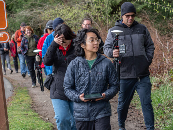
On a soggy Saturday in March, more than 30 volunteers gathered in Kenmore’s Saint Edward State Park to help re-map the trails that wind through the popular green space. University of Washington Bothell student intern Janelle Adsuara led “Mapping the Park 101,” which attracted individuals and families who were mapping hobbyists, outdoor enthusiasts and neighbors eager to try out geographic information systems technology.
All paths in project leader Adsuara’s life seemed to point to Saint Edward State Park. She grew up in the San Francisco Bay Area, where she explored the region’s parks, beaches and trails by foot and bicycle. The similarities she found in greater Seattle, where big cities snug up to vast natural spaces, influenced her decision to pursue a degree in Environmental Studies and a minor in GIS at UW Bothell.
“I’m fascinated by the intersection of urban and natural environments,” she said. “It’s a unique experience that makes me more aware of social injustices — racial, class, public health. How can we make the world more sustainable?”
Annika Halvorson, a volunteer at the event and a recent graduate from the UW in Seattle, had a similar childhood experience outdoors — and desire to make an impact now.
“I grew up going to the playground in the park and the trails, and I would always get lost,” she said. “I wanted to give back to my community and use my knowledge to do some good for the park that I have always loved.”
Read the full blog over on UW Bothell News!