The ancient Greek philosopher Socrates once wrote, “Man must rise above the Earth, to the top of the atmosphere and beyond, for only thus will he fully understand the world in which he lives.”
More than two millennia later, that sentiment still rings true among scholars and explorers who continue to investigate the complex nature of life on Earth.
The overall sentiment of Socrates’ words may have been more philosophical and metaphorical, but today one practical application of this concept is remote sensing — the process of gathering data and information without making direct visual or physical contact with the subject or object of study.
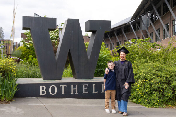
For Dr. Santiago Lopez, professor in the University of Washington Bothell’s School of Interdisciplinary Arts & Sciences, remote sensing is essential to his research on the physical and human dimensions of global change.
Data from above
From the moon landing to the Global Navigation Satellite System, humans have been probing beyond the Earth’s atmosphere for nearly a century. Remote sensing, however, dates back even further to the first aerial photograph, taken from a balloon in 1850.
Advances in remote sensing technology since then have provided scientists with the means to study the Earth in greater detail from afar using tools such as satellites, aircraft and drones. One of its most vital applications today is climate research.
“We’re in a much better place right now in terms of technology but a much worse place in terms of the health of the Earth,” Lopez said. “With more data, we have a better understanding of what’s going on, and we cannot say that climate change isn’t happening or that it’s a hoax.
“It isn’t new — we’ve known about climate change dynamics for almost two centuries — but we now have a very clear picture of what is happening globally thanks to this technology.”
Lopez has long had a fascination with the changing environment and the technology that can be used to monitor it. Much of his research lies at the intersection between climate and land use change. He’s also interested in how social behaviors drive these changes.
“Man must rise above the Earth, to the top of the atmosphere and beyond, for only thus will he fully understand the world in which he lives.”
Socrates
Nighttime picture of Earth taken on April 2, 2026 during the Artemis II mission. Image credit: NASA.
The human element
Lopez began collaborating in 2022 with Dr. Cesar Ivan Alvarez, assistant professor at Salesian Polytechnic University, on air quality research in Ecuador tied to social disruptions erupting from economic pressures and epidemiologic events.
When it comes to air quality, the U.S. has robust networks of ground monitoring stations that collect data on particulate matter, ozone, nitrogen dioxide and carbon dioxide levels. Many countries in the Global South, however, lack that infrastructure — and remote sensing helps to fill the gaps.
“Part of the philosophy behind the work I do is asking, ‘how do we learn from all these places around the world when we have very limited resources and funding to visit them?’” Lopez said. “We live in this geopolitical world that is very complex, and there are more barriers to access in certain places.”
Using satellite data, the team investigated air quality changes in Quito, Ecuador, during short periods of social upheaval — including events caused by civil protests in 2019 and the pandemic in 2020. What they discovered was that social upheaval events can have both positive and negative short-term impacts.
Social protests, usually accompanied by increased human activity, led to some increased air pollution levels in the city’s center, yet air quality in general improved during the pandemic due to reduced vehicle traffic and other activities.
“After lockdowns ended, everything went back to how it was and, in some cases, even worse,” Lopez said. “This data illustrates how complicated social behavior can be to predict, but remote sensing can help tell those stories and make those types of connections to support further research and decision-making.”
“Remote sensing can only tell a part of the story. Ground truthing is also vital, and it’s important that students know how to do field validation.”
Dr. Santiago Lopez, professor, School of Interdisciplinary Arts & Sciences
Biological invasions
Remote sensing is also useful in tracking biological changes and movement in the environment — from disease-carrying mosquitos to invasive plant species that harm ecosystems. One example of this in Washington state is the spread of invasive English holly, which the state recently classified as a Class C noxious weed (thanks in part to research that started at UW Bothell).
In his latest research, Lopez and UW Bothell alumni Neal Hicks (Earth System Science ’24) and Jacqueline Feola (Environmental Studies ’24) used distribution modeling and spatial analysis to identify some of the key environmental factors that influence the holly’s spread.
The remote sensing offered one piece of the data puzzle, but the team also relied on data and observations acquired in the field to get a better picture of where the holly was most prevalent. In both his research and his classes, Lopez emphasizes the need to always conduct ground truthing — collecting data on-site — to confirm and complement the remote data.
“Remote sensing can only tell a part of the story. Ground truthing is also vital, and it’s important that students know how to do field validation,” he said. “Together, they can provide a narrative and an explanation about a particular environmental change process — in this case an invasion process.”
The study revealed that warmer temperatures and proximity to the forest edges, trails and other human-made features significantly enhanced the plant’s presence and dispersion, particularly in forest communities dominated by evergreen coniferous trees like Pacific Douglas fir, western red cedar and Western hemlock.
Down to Earth
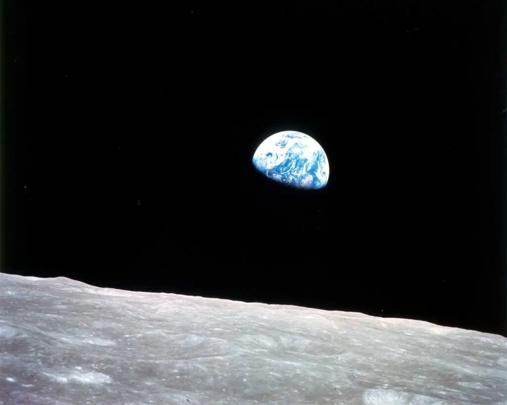
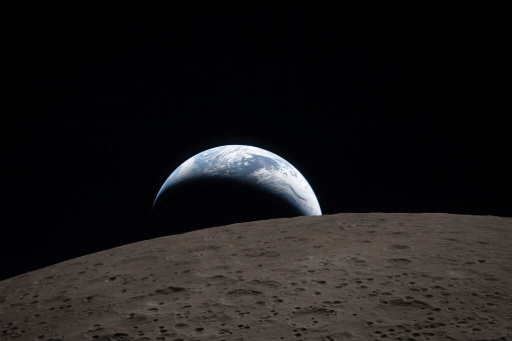
With the recent completion of the Artemis II space mission — in which humans traveled farther than any others in history and became the first to view the far side of the moon — Lopez is reminded of how a photo from afar forever changed how people viewed the Earth.
Astronaut William Anders took the first color photograph of Earth from space during the Apollo 8 mission in 1968, and that picture is considered by many to be an impetus for greater concern about the Earth’s environment.
“That first image, which was labeled ‘Earthrise,’ was shared everywhere and, for many, it showed how the Earth is this fragile ecosystem that needs to be protected,” Lopez said. “It was kind of the icon of the early environmental movement. It also marked a pivotal shift from analog aerial photography interpretation to the era of digital remote sensing and data analysis.”
The Artemis II crew captured a similar image and again ignited global discussion about the health of Earth and the impacts of climate change. Lopez noted that it’s a timely reminder that a picture isn’t just worth a thousand words — it’s a priceless icon for change.